9 May 2019

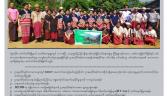
POINT did participatory mapping on Customary Land and Land Use system of Indigenous communities in order to show customary land tenure system in Myanmar. Customary land or territory means the territory agreed by neighbouring villages as a land or territory owned by a particular community. Land use refers to types of land use such as watershed area, communal forest, religious land, agricultural land, orchard land and rotational farming area which the community determined according to customary law.